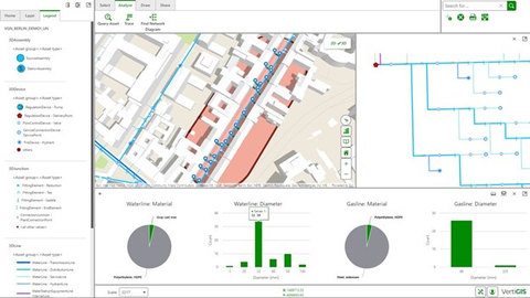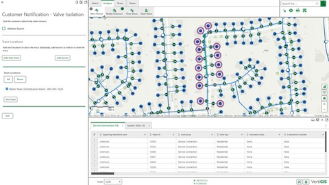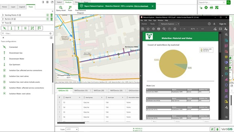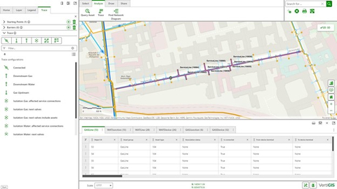


Esri, the global leader in geographic information system (GIS) software, launched the ArcGIS Utility Network in 2018. VertiGIS Networks is a state-of-the-art product line -- built from the ground up -- that allows utilities to visualize, trace, analyze, and edit their ArcGIS Utility Network data in both web browsers and native apps with online and offline workflows.
“ArcGIS Utility Network is a proven foundation for utilities to store and manage their network data. The solutions provided by VertiGIS Networks deliver that foundation to end users through modern and performant web applications that makes working with complex data easy," said Jeff Rashid, Director of Global Business Development - Utilities and Telecommunications at Esri.
“We’re really excited to see that VertiGIS is also offering their solutions in the cloud – it enables a rapid delivery model so that small and mid-tier utilities reduce the time to value, and so that their users can take advantage of the power provided by the Utility Network immediately.”
Besides providing a state-of-the-art user experience, VertiGIS Networks can automate the exchange and synchronization of utilities’ data between GIS and SAP or other enterprise systems. This means that utilities avoid duplicate data entry in their systems while ensuring high quality and integrity in their respective databases. SAP Integration and Certification Center (SAP ICC) has certified the solution for integration into SAP S/4HANA.
Drew Millen, CTO for VertiGIS adds, “We’re laser focused on ensuring that VertiGIS Networks enables end-users to seamlessly access accurate, high-fidelity data for their workflows. We've addressed this need with elegant UX design and our web- and mobile-first strategies, as well as with the right back-office integrations to ensure data is accurate and current.”
About VertiGIS
VertiGIS is a leading asset management and geographic information systems (GIS) solution provider and software developer. Their focus is on the development of software solutions and services that enable professionals in the utilities, government, telecommunications and infrastructure market segments to connect their business processes with spatial management technology. Used by more than 5,000 customers and millions of end users around the world, VertiGIS' product portfolio is designed to enhance the capabilities of leading GIS software, especially Esri's ArcGIS®. For more information visit vertigis.com.
About Esri
Esri, the global market leader in geographic information system (GIS) software, location intelligence, and mapping, helps customers unlock the full potential of data to improve operational and business results. Founded in 1969 in Redlands, California, USA, Esri software is deployed in hundreds of thousands of organizations globally, including Fortune 500 companies, government agencies, nonprofit institutions, and universities. Esri has regional offices, international distributors, and partners providing local support in over 100 countries on six continents. With its pioneering commitment to geospatial technology and analytics, Esri engineers the most innovative solutions that leverage a geographic approach to solving some of the world's most complex problems by placing them in the crucial context of location. Visit us at esri.com.