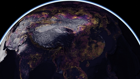


This new series of analytical layers available in ArcGIS Living Atlas of the World leverages decades of historic observations along with patterns of land use and development to let users predict land cover in 2050. Each 300-meter pixel of the Earth is classified by land cover type and the vulnerability of human activity to modify it. The map includes three crucial layers that detail change in land cover up to the present, risk to that land, and the projected future change.
“The ability to understand the challenges posed by climate change to the planet alone is critical to our survival," said Jack Dangermond, Esri founder and president. "But the power to virtually see into the future and visualize these material issues as they might unfold tomorrow is transformative. This new map demonstrates one way GIS can help us use technology to build a more sustainable world."
In June, Esri released the first high-resolution global land cover map, supporting change detection and highlighting planetary land changes, especially related to the effects of human activity. Similar to that release, planners worldwide can use the 2050 Global Land Cover Map to better understand the geography around them with distinctive land cover, as well as human activity affecting them. Specifically, decision-makers can project future land cover patterns, allowing them to better assess the impact risks imposed by development or industry in a given location.
“Advancements in our understanding of land change processes and the power of geospatial neural networks has afforded us unprecedented opportunities to anticipate environmental changes ahead,” said J. Ronald Eastman, Professor of Geography and Director of Clark Labs at Clark University. “This provides us with the opportunity, and obligation, to be proactive in our stewardship of natural resources.”
Esri is releasing this mapping resource under a Creative Commons license to encourage broad adoption and ensure equitable access for planners creating a more sustainable planet. The content will be made available in ArcGIS Online as a map service and be freely available for use by its 10 million users. It will also be available for download and viewing. To explore the new 2050 Global Land Cover Map, visit https://livingatlas.arcgis.com/landcover-2050/.
About Clark Labs
Clark Labs focuses on the development and deployment of geospatial modeling and monitoring tools for sustainable development. Founded in 1987 by Professor Ron Eastman of the Graduate School of Geography, Clark University in Worcester, Massachusetts, USA, the organization has pioneered the development of tools for land change modeling, geospatial decision making, environmental time series analysis and remote sensing image analysis. Partnering with organizations such as the Gordon and Betty Moore Foundation, Esri, Conservation International, the World Conservation Society, the World Wildlife Fund, Google, USDA and the United Nations Environment Programme, Clark Labs leverages its academic base to develop innovative and customized research tools, provide software solutions to organizations in need, and apply geospatial expertise to a range of real-world problems.
About Esri
Esri, the global market leader in geographic information system (GIS) software, location intelligence, and mapping, helps customers unlock the full potential of data to improve operational and business results. Founded in 1969 in Redlands, California, USA, Esri software is deployed in more than 350,000 organizations globally and in over 200,000 institutions in the Americas, Asia and the Pacific, Europe, Africa, and the Middle East, including Fortune 500 companies, government agencies, nonprofits, and universities. Esri has regional offices, international distributors, and partners providing local support in over 100 countries on six continents. With its pioneering commitment to geospatial information technology, Esri engineers the most innovative solutions for digital transformation, the Internet of Things (IoT), and advanced analytics. Visit us at esri.com.
Copyright © 2021 Esri. All rights reserved. Esri, the Esri globe logo, ArcGIS, The Science of Where, esri.com, and @esri.com are trademarks, service marks, or registered marks of Esri in the United States, the European Community, or certain other jurisdictions. Other companies and products or services mentioned herein may be trademarks, service marks, or registered marks of their respective mark owners.